
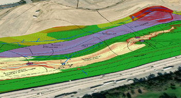

Geospatial Solutions for Your Advanced Engineering Needs
At CNC Engineering, we offer precision in providing Geospatial Solutions that support your engineering projects across the nation. Give us a call today to see how our spatial expertise can amplify your operations.
GIS (Geographic Information Systems)
Creating, managing, and presenting GIS data is an essential asset in today’s world. We provide clients with expert knowledge and creativity to manage, analyze, and present a wide variety of data. Our GIS services include:
Data Management
- Database Design
- Develop custom data models and best practices to build efficient GIS databases
- Address Data Management
- Geocoding – Convert physical addresses to a geographic location on the Earth’s surface
- Reverse Geocoding – Convert geographic locations on the map to a description of a location, such as a place or address.


Get in Touch for Premium Geospatial Solutions!
Follow Us on Social Media:

© 2026 CNC Engineering